 |
RUGGED PATH & SELWORTHY 30 August 2017 |
|
| Higher Tn Church On Top Rugged P. Bossington Selworthy Return Read Me |
My Circular Walk over the Rugged Path to Selworthy
The day started rainy and the weather forecast was for inclement weather all day. So I thought I'd go up to Higher Town and potter around. In pottering around I could see what the Weather Gods really intended, forecast or no forecast. I spent a while in the church, having accepted an invitation by the Bell Ringers to have a look at how they practiced their art, on this occasion using computers so as to maintain good relations with the neighbours! I was then invited to go further up the winding stairs to the belfry.
The narrow rugged path was high above the Bristol Channel.
The blue sky had only a few wisps of cloud.
It all gave a great feeling of the Great Outdoors!
After that I went on to join the South West Coast Path. As I reached the Rugged Path, the clouds had lifted - luckily not according to the weather forecast! For the rest of the day, the sun shone benignly on my modest peregrinations along the said Rugged Path, then round Bossington Hill, and via Saint Agnes's Well to Selworthy Green. I then ascended Selworthy Combe and headed for that point near "The Beacon" where the pine trees frame the view over Minehead and beyond to the Quantocks. The setting sun gave this view a special feel, a fitting finale to my sojourn in Minehead!
So here is what this page has in store for you. Here indeed is your chance to find out how I enjoyed my nice mid-week end-of-August walk.
- Higher Town
- Saint Michael's Church and its Belfry
- On Top - Link to The South West Coast Path
- The Rugged Path
- Hurlstone Point and Bossington Hill
- Selworthy
- Homewards
- Walk Features
- Please Read Me - Thank you!
Enjoy your browse!
Higher Town
The paving in the square around Queen Anne's Statue was still shiny with the overnight rain. Indeed, even as I set off for Higher Town, was still some gentle drizzle. Anyhow, I set off - rain or no rain.
The paving stones around Queen Anne's Statue in Wellington Square were still shiny.
However, I rose to higher things, and soon reached Higher Town.
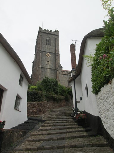
Here are the Church steps, ...
... from the top of which there's a nice "West Country" view along the way I came up.
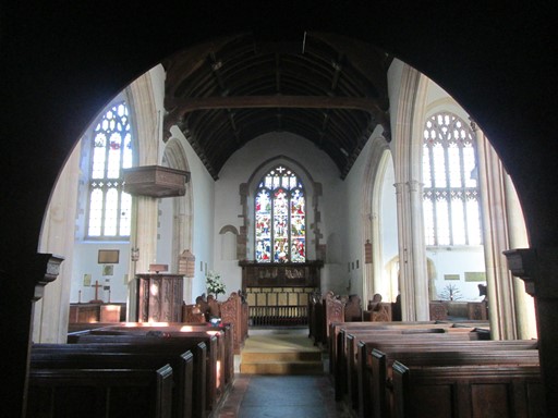
Saint Michael's Church and its Belfry
It seemed a good idea to revisit Saint Michael's Church, and after that to gauge the weather conditions. It turned out to be an interesting visit. Near the mediaeval font, I saw that the door leading to the spiral staircase ascending the church tower was open, and that the said staircase was lit. Going up, I first met the bell ringers, practicing in the room below the belfry. The bell ringers bid me welcome and explained some of the aspects of their art. Then I was invited to the belfry above, where I could admire the bells and the arrangement of ropes and pulleys used to ring them. There are 10 bells, each weighing from several hundred weights up to about ½ a ton. The weights of the bells, of course, imply an appropriate arrangement of pulleys to allow mere mortals to activate the said bells.
Saint Michael's Church loomed up on this overcast morning.
It's still a bit wet outside, so I enter the church with the idea of getting some better pictures of the three Royal Coats of Arms.
George II.

Queen Anne.
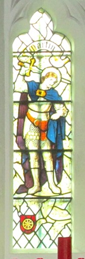
Close by, Saint Martin appears in a stained glass window.
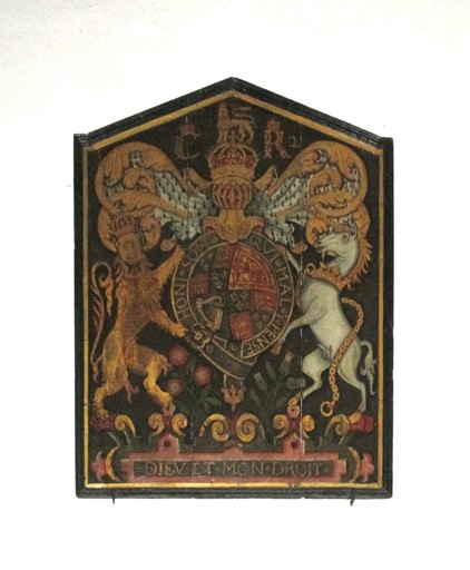
Charles II.
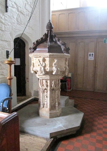
Near the mediaeval font ...
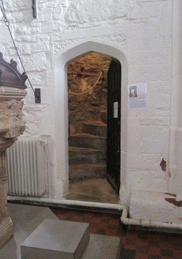
... the doorway was open and the stair case was lit.
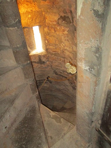
This required further investigation! The narrow spiral staircase led to the bell ringing room - with practicing bell ringers! - and then on to the belfry.
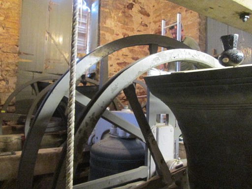
There are 10 bells, each weighing from several hundred weight ("cwt") up to about ½ a ton.
What was that James Bond film, where some poor individual was caught in the
Amsterdam Clock Museum at mid-day?
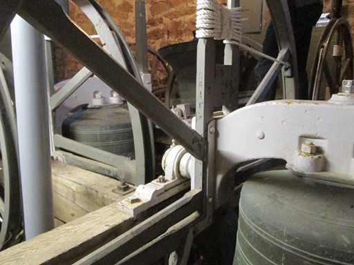
The weights of the bells, of course, imply an appropriate arrangement of pulleys
to allow mere mortals to activate the said bells.
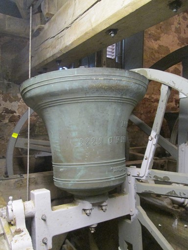
This bell was cast in 1888.
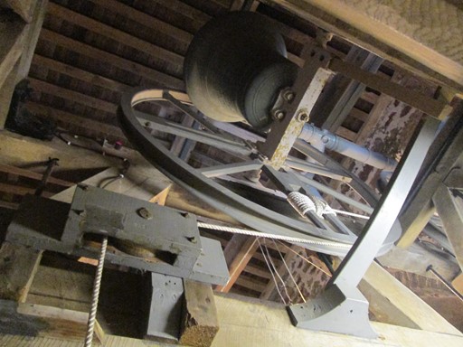
Everywhere, there seem to be pulleys, ropes ...
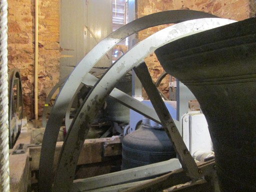
... and bells!
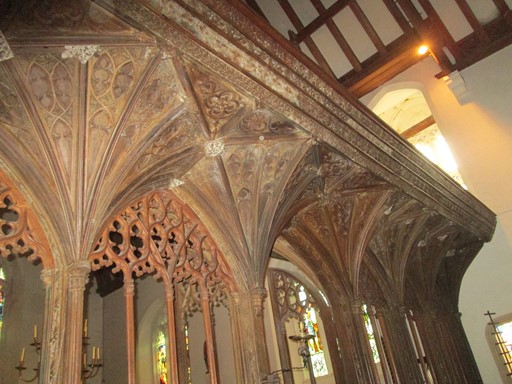
Here is the mediaeval carved Rood Screen,
so typical of the "wool" churches in this part of Somerset.
Here are the long term residents, whoever they may be!
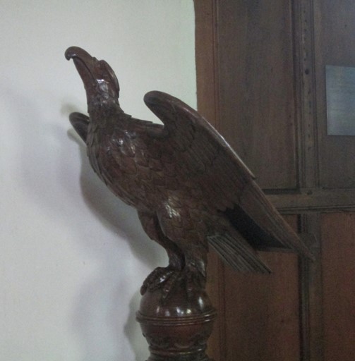
The eagle takes flight with the words of the preacher.
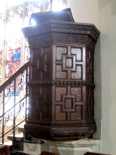
More words can flow from the Jacobean pulpit.
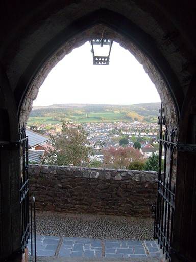
And now it's time to test the weather.
On Top - Link to the South West Coast Path
From Higher Town it's easy to get to the South West Coast Path without having to go down to the harbour. A local, exercising his dog, told me that part of the path was actually metalled in order to create a road for the wealthy in the locality who wanted to go out for a scenic ride in their horse and carriage. He showed me the difference between the normal oak tree and the Holm Oak by pointing to the leaves of the two trees next to each other. He reminded me of the famous place nearby where one could see Minehead nicely framed by pine trees - I would come to this spot in the evening. He also spoke about the confusion map makers have about where North Hill actually is. Also, he said it was possible to leave the Rugged Path half way despite official suggestions to the contrary! So, a veritable mine of information! It often pays to speak to people!
This part of the metalled path.
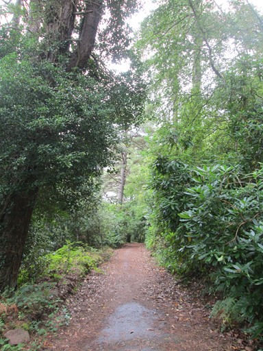
There's a lot of lush summer growth,
which unfortunately partly obscures the view across to South Wales.
Coming out of the woods seems luckily also to be a matter of coming out of the woods weather-wise. The skies look as if they are clearing and making way for sunshine!
There are heavy clouds clearing to the east.
To the west, the sun making itself felt.
Another look towards the east ...
... and the picturesque clouds before they go.
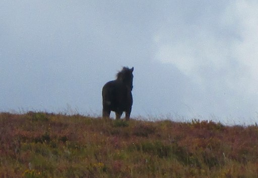
On the horizon, an Exmoor pony comes ...
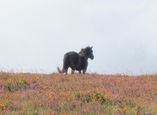
... and goes.
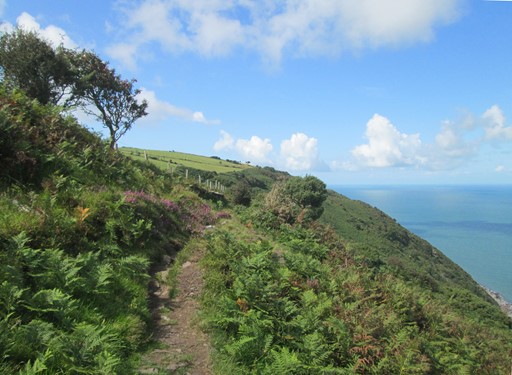
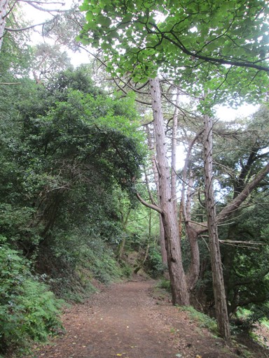
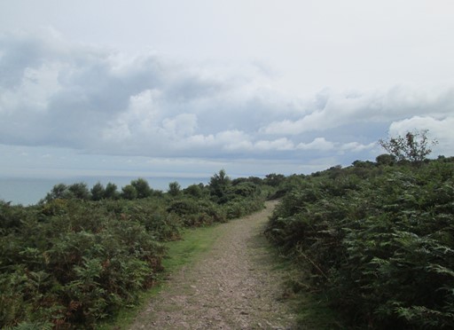
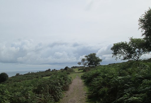
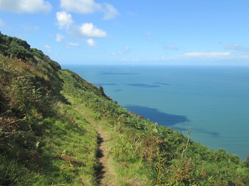
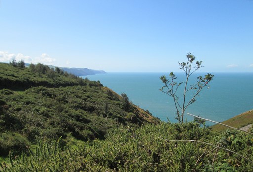
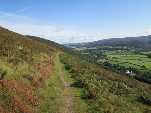
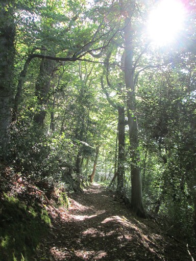
Rugged Path
The Rugged Path runs roughly parallel to the upper part of the South West Coast Path (SWCP). In other words, it's a rugged alternative, all 2½ miles of it, to the upper instantiation of the SWCP. The Rugged Path, as is to be expected, has plenty of ups and downs. There are also some nice narrow bits high above the shore. All very picturesque.
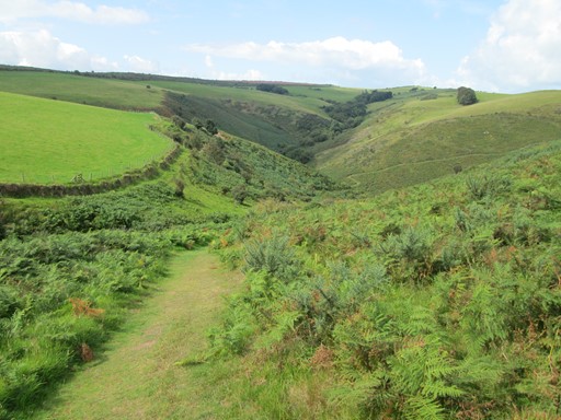
The sun is shining as I enter the green valley ...
... with ferns everywhere.
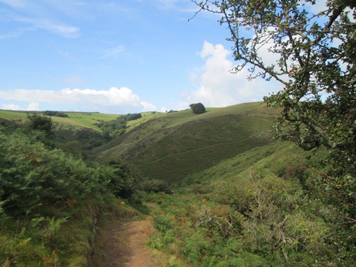
Now the narrow Rugged Path snakes out to the coast ...
...where one gets the feeling of the Great Outdoors. Sea, sky and a rocky ledge.
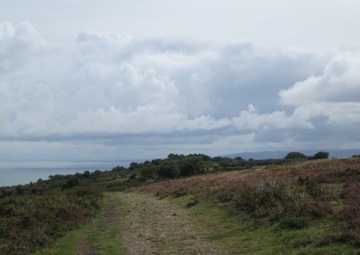
Looking back to the east I can see the rocky path along which I have come. Also, I can see that the remnants of the clouds are disappearing fast in the said easterly direction.
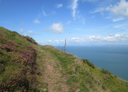
Towards the west, ...
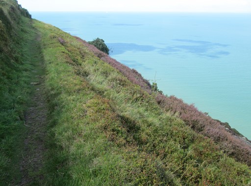
... the narrow path continues for a while ...
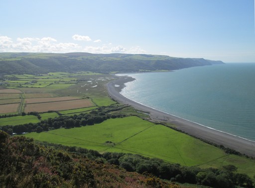
... until I reach an open spot with westward views along the coast beyond Porlock Weir.
The fine view persists ...
... right up to the end of the Rugged Path.
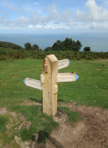
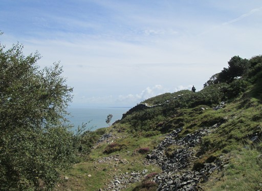
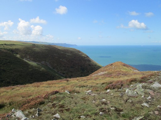
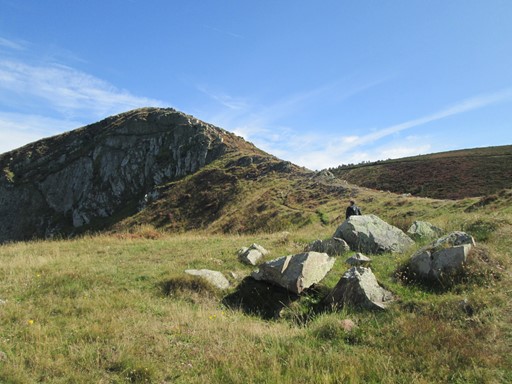
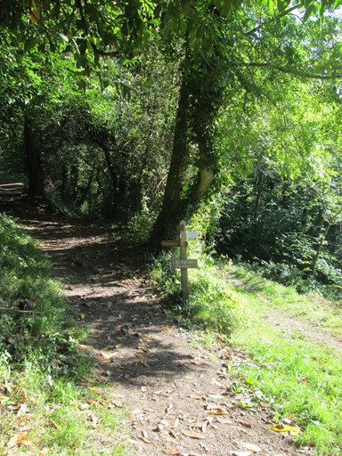
Hurlstone Point and Bossington Hill
At the end of the Rugged Path there were a number of options. I tried to reach Hurlstone Point from above. In 2009 I reached Hurlstone Point from the "level" path below. However, the path from above got lost in prickly gorse, so I enjoyed the views and landscape on the way, and then returned to go around the side of Bossington Hill. From the said hill, I could then take the path through the woods to Selworthy.
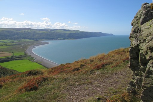
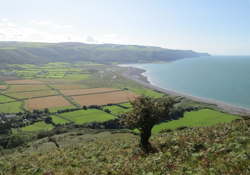
Striking out from the top towards Hurlstone Point, I can take in
more fine views of Porlock Weir and the coast beyond.
The landscape above Hurlstone Point is quite exposed ...
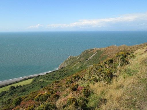
... and further down the prickly gorse covers the hillside and the footpath that - according to the OS® map - should run through it.
The way I took was worth taking for the views. In view of the abundant prickly gorse, I decided not to descend to Hurlstone point, ...
... heading, instead, for Bossington Hill ...
... from which there were more nice views.
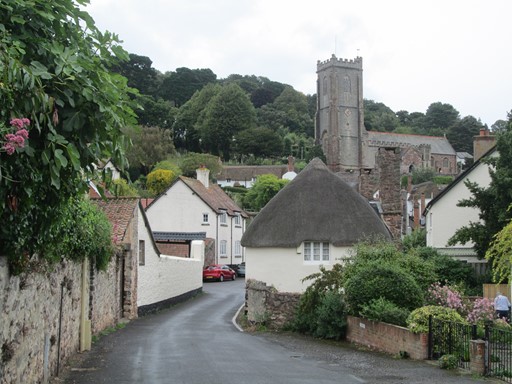
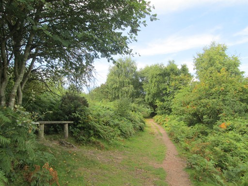
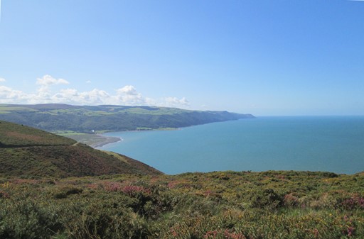
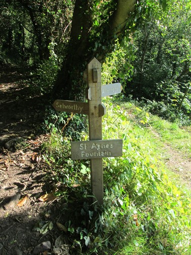
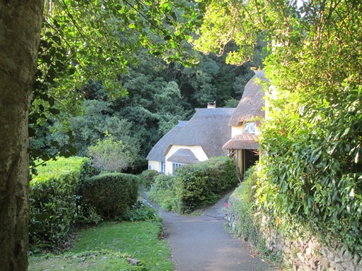
And so to Selworthy
From Bossington Hill, I took the path through the woods, past Saint Agnes's Fountain. I enjoyed the fine views across to Dunkery Beacon. Eventually, after not too long a time, I reached the thatched cottages on Selworthy Green. The Green looked very nice in the late afternoon sun. I then took another interesting look around Selworthy's 15th century (Grade I listed) church before heading up Selworthy Combe for the last "leg" (excuse the pun) of my walk.
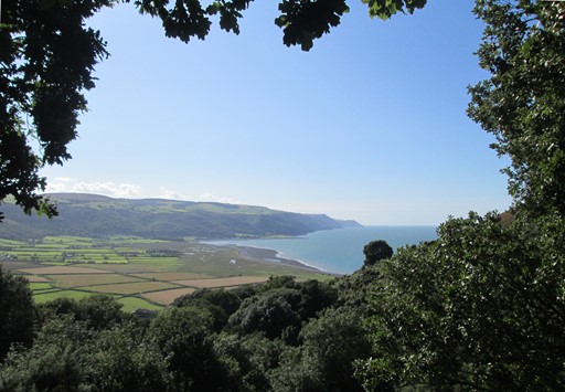
From the woods, the fine views towards Porlock Weir and the coast beyond persist.
Woods often have the fine interplay of sunshine and shade. Today is no exception.
Eventually I reach Saint Agnes's Fountain.
There's not much of a fountain, but in days gone by it may have been an important source of water.
It may be a case of a sinking water table.
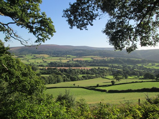
As I get closer to Selworthy Green, fine views appear to the south of Dunkery Beacon.
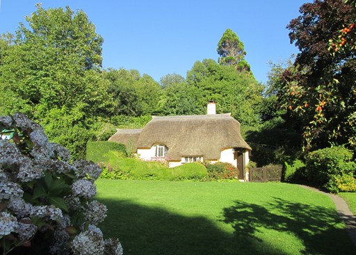
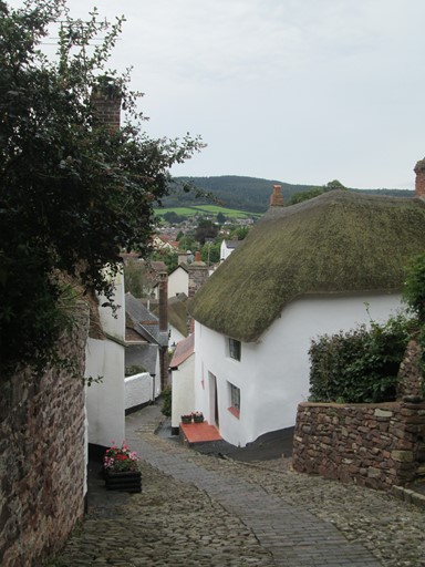
And here's Selworthy Green, with its thatched cottages ...
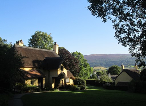
... and view towards Dunkery Beacon.
The late afternoon sun makes for nice lighting effects!
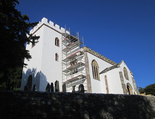
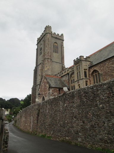
Here's Selworthy's 15th century church of All Saints.
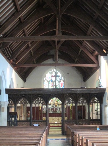
I take a look inside.
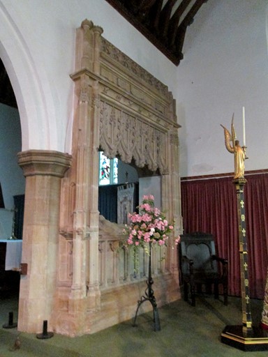
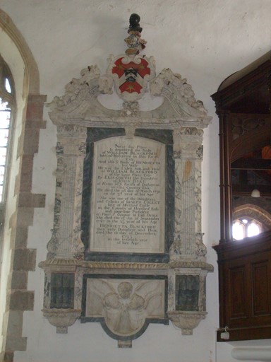
This memorial is to Charles "Staynings", his wife and daughter, and was put up in 1701.
One member of the family lived to - for the time - ripe old age of 78!
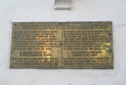
This memorial is dedicated to William Stenynges who "departed this lyfe the fivetenth daie of January in ye yere of our lord god a thousand five hundred four score and nyne" (i.e. 1589). (The spelling is of course in Tudor English). William's wife is also mentioned and the text is written in both Latin and English.
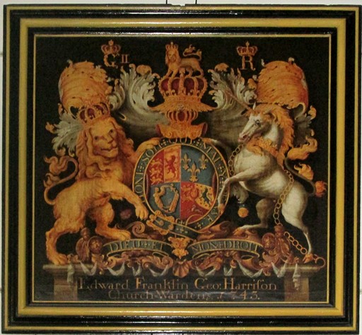
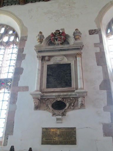
This memorial is to members of the members of the Blackford Family and refers to the year 1733. It highlights a connection with the "President of Fort St George in East India". By today's standards, three of the persons referred to died relatively young - ages 7, 23 and 37.
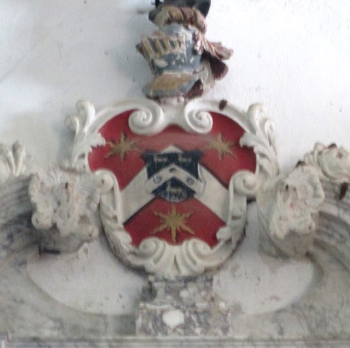
The memorial is topped by the fine family crest.
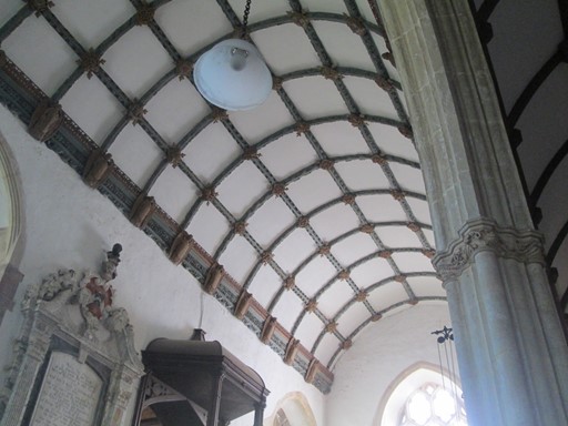
The roof has some interesting carved bosses - each one different.
In days gone by, a lot of patient and skilled work must have gone into producing this roof.
A now it's time to leave for my return walk to Minehead.
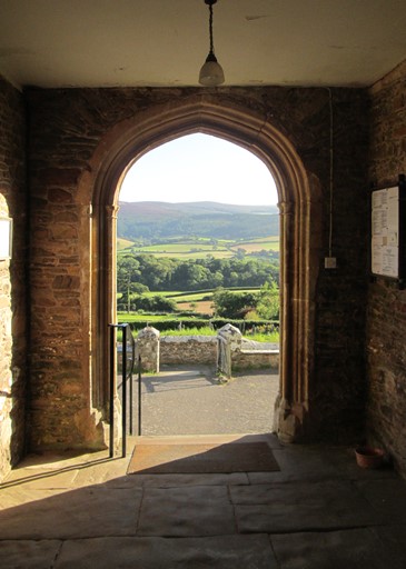
From the church door, Dunkery Beacon is bidding me farewell.
Homewards
As the shadows are lengthening, I go up Selworthy Combe. From the top, I can look again across to South Wales. The signpost points to the Rugged Path which I had traversed in the morning. The woods and the path to Minehead's Higher Town are close. A deviation to "The Beacon" brings me to the famous view through the pines over Minehead. On the way to Higher Town, I pass the Japanese Gate before reaching Minehead's church of Saint Michael which I had visited - belfry and all - this morning in the fulfilled hope of the weather clearing.
I reach the upper South West Coast Path
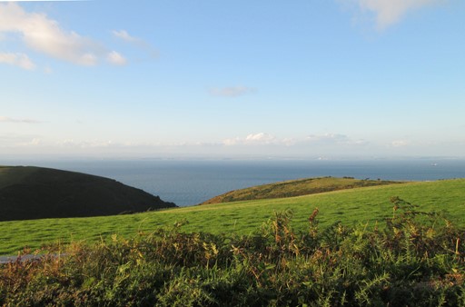
and enjoy a last view across the Bristol Channel to South Wales.
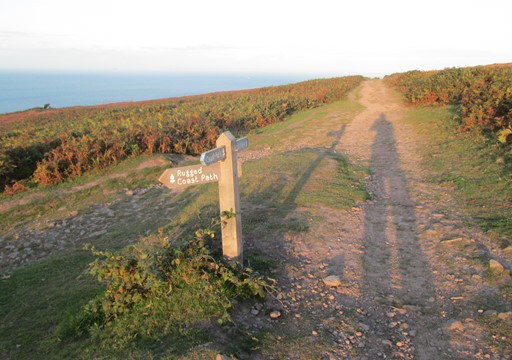
Here's the turn off to the Rugged Path, which I took this morning as the sun was heralding fine weather for this my last day in Minehead. My shadow has lengthened dramatically!
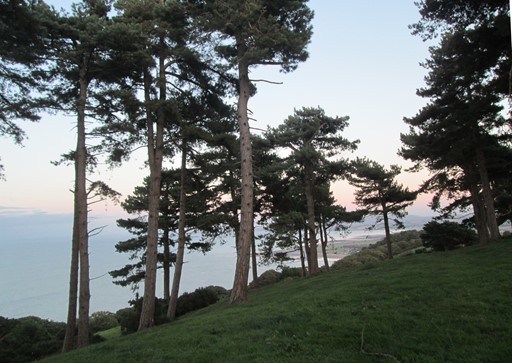
Here are the famous pines, ...
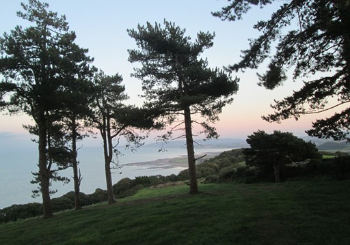
... framing an impressive evening view across Minehead and the Quantocks beyond.
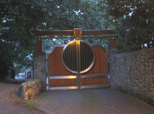
Here's the Japanese gate.
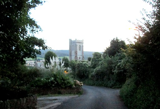
Here's Minehead's Saint Michael's Church.
I'm almost back!
Finale
This was my last day in Minehead, made all the sweeter because the weather, contrary to forecasts, turned out fine and sunny. It's been a succession of nice days in Minehead, with good company over the August Bank Holiday. Tomorrow I would take the mid-day train from Taunton to Paddington as part of my return home, taking with me memories of another excellent away break in the West Country. Thanks to all who contributed and made these days such a success!
Updated: 2017-09-26 @22:09
SAGAX REX HANC RETIS ORBIS PAGINAM PINXIT ANNO MMXVII
© Eric Scharf 2017